
ASSIGNMENT GUIDELINES:
Mapping New York City's Nineteenth-Century Latina/o Press

This assignment was developed by Kelley Kreitz for use in Pace University's LIT 211J American Voices course. We welcome re-use and revision of this assignment for educational purposes.
OVERVIEW
New York City has long served as a major publishing center in the history of Latin American and Latina/o literature. At the end of the nineteenth century, the city’s Latina/o American publishing community was centered in the very neighborhood that surrounds Pace University. Understanding lower Manhattan’s role as a publishing center for Latin Americans living in New York at that time will provide us with examples of the ways in which print history can inform our understanding of the formation of Latina/o literature and culture. This session will also give us a chance to experience the ways in which our current understanding of this history is still unfolding. As we will see, there are many gaps that remain to be filled in the history of the Latina/o press in the nineteenth century in the United States.
LEARNING OBJECTIVES
This assignment has been designed to help you to:
- Develop an understanding of the existence and size of the Latina/o press in NYC in the nineteenth century.
- Gain familiarity with research tools with basic research tools for finding scholarly articles and archival materials (MLA International Bibliography, WorldCat).
- Gain familiarity with Google Earth as a mapping tool and consider its usefulness for research and presentation purposes.
- Practice presenting research findings in a nontraditional format.
WHAT WE WILL CREATE
The final product of this assignment will be a Google Earth map that provides viewers with a tour of some key sites of the Latina/o publishing community in Manhattan at the end of the nineteenth century. Depending on what each of you finds during the research process, this map may include images (either those you take on your own at the site to which you are assigned, or historical images that you find online), and it should also include notes. You might also consider creating a video or an audio file to help show how much has changed since a given publication occupied a site in the neighborhood surrounding Pace. Feel free to be creative as you consider how to convey your findings on the map. Think of yourself as a tour guide who is designing an engaging and informative experience for anyone interested in the history of the Latina/o press in New York City.
HOW IT WORKS
Step 1: Before class
You will be assigned to a group that is in charge of two former sites of the nineteenth-century Latina/o press in New York City. (Each is only a short walk or subway ride from the Pace campus.) Together, you will be responsible for answering the five questions listed below. You can answer these questions individually or divide them among the members of the group. How you organize the work is up to you.
* In addition to answering the questions below, you will need to make sure that at least one member of your group has a laptop with the free version of Google Earth installed and ready to use in class .
- What basic information is available about your publications and its writers or editors? (Was there anything mentioned in the Kanellos article? Were you able to find anything with a basic Google search?)
- Are there scholarly articles available about your publications? (Go to Pace University Library – Databases – MLA International Bibliography)
- Are there copies of the original publication available? If so, where? (Go to Pace University Library – Databases – WorldCat. Under the advanced search options, click “Serial Publications”)
- Are there other archival materials relating to this publication and/or editor available at the New York Public Library? (Go to archives.nypl.org)
- What is the building where the publication was headquartered being used for now? Is there any indication at that site of its history in relation to New York’s Spanish-language press?
Note: In some cases you will find plenty of information about your assigned publication or its writers and editors. In others, there will be little to no information. This is part of the challenge of studying the Spanish-language press in this period. Document what you find, as well as the gaps that you run into.
Step 2 - In Class: Add and Annotate Your Sites in Google Earth
Working with your group, you will use this time to compile your portion of our Google Earth map. Review the notes, images or other files that you found or created, and any questions that you ran into, and use them to create your portions of our map of the Latina/o press in New York City. At the end of this working session, your group should have a completed Google Earth file with your assigned sites marked and any pertinent information about that site included. You should email that file to the instructor.
The instructor will be available during this session to answer questions about the research and using Google Earth. You may also find the following online tutorials helpful.
- Google Earth Outreach video on Making Interactive Maps
- Annotating Google Earth (especially the early part on creating placeholders. Note that in addition to using latitude and longitude lines as mentioned here, you can also enter an address to locate a place on the map.)
- Creating Virtual Tours in Google Earth
- Save a kmz file in Google Earth
Step 3 - During Class - Group Presentations
Each group should come prepared to offer a five- to ten-minute presentation on its portion of our Google Map. You can designate a presenter or divide the speaking among the members of your group. All should be prepared to answer questions.
The instructor will compile the files that you sent after our working session on 9/19 so that we can view our completed map of the Latina/o press as you present on your portions of the map.
GROUP ASSIGNMENTS
Group 1
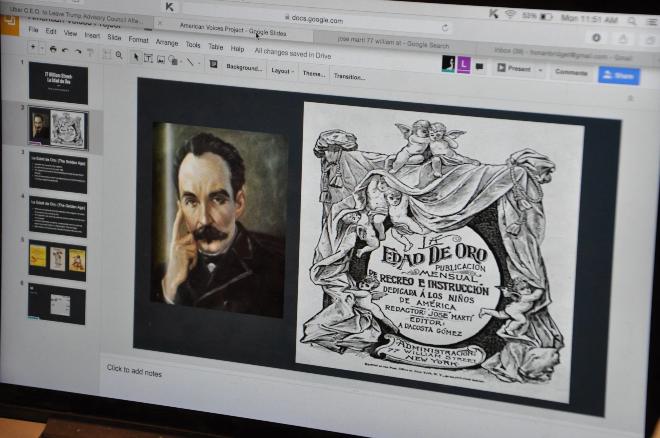
- Office of La Edad de Oro [The Golden Age] and possibly José Martí’s office in general before 1890s – 77 William St.
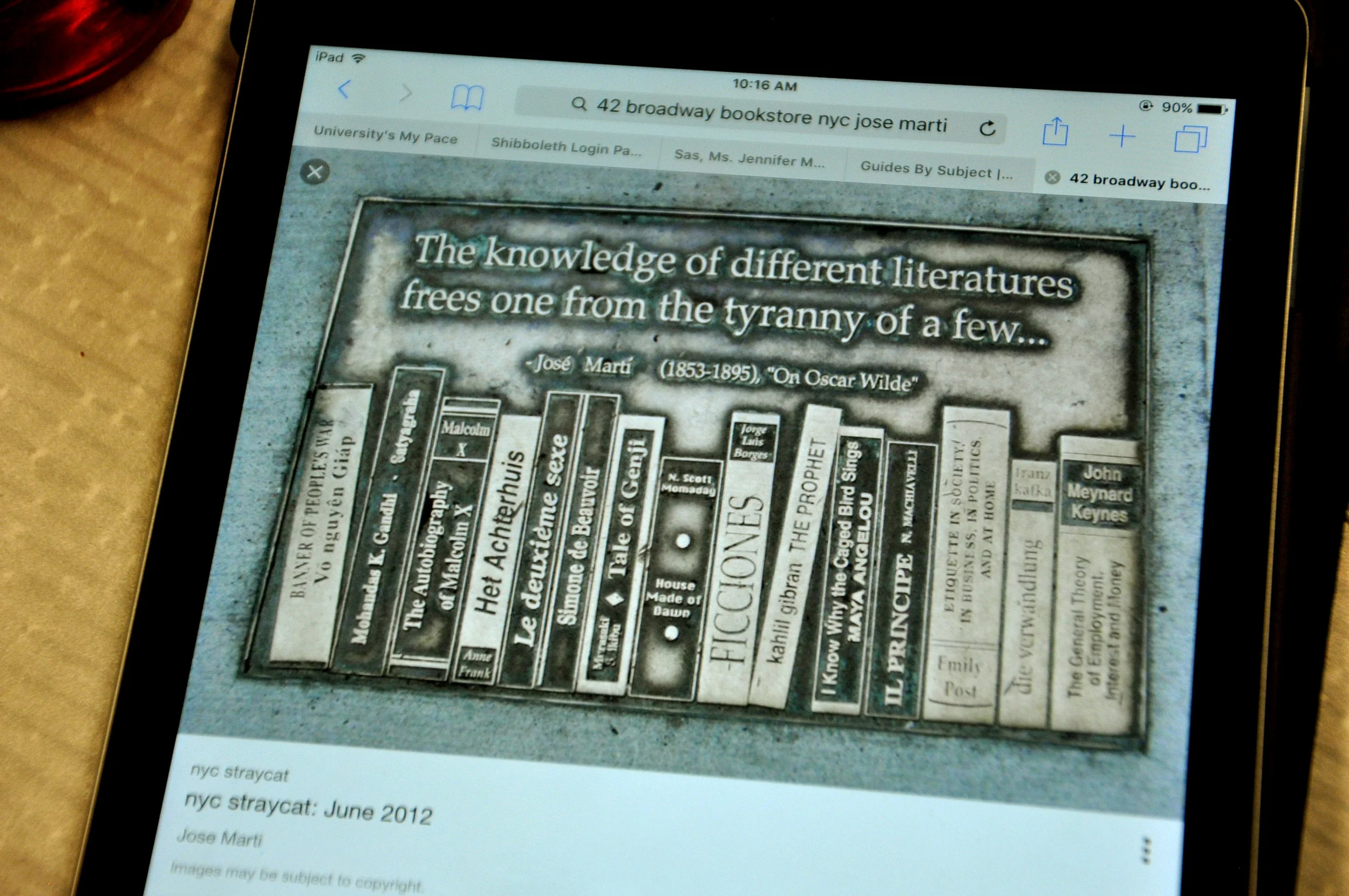
- Bookstore specializing in Spanish and Latin American books and printing offices of Nestor Ponce de León in 1873 – 40 and 42 Broadway
Group 2
- Office of La Revista Ilustrada de Nueva York [Illustrated Magazine of New York] (owner Elías de Losada, editor Nicanor Bolet Peraza) – 116 Reade St. (Thurber Building)
- Ricardo de Requesens - Printer of La Revista Ilustrada in 1886 - 14 Ann St
Group 3
- Offices of El Porvenir [The Future], edited by Enrique Trujillo – 51 New St., 1896
- El Economista Americano [The American Economist]- 56 Pine Street
Group 4
- Las Tres Américas [The Three Americas], edited by Nicanor Bolet Peraza starting in 1893 - 197 Pearl St.
- El Espejo [The Mirror] - 4 Cedar St
Group 5
- 284 and 286 Pearl St. – Site of Sotero Figueroa’s printing house, Imprenta América, starting in 1889 (printed Martí’s Patria [Homeland] among many other NYC-based Spanish-language publications.)
- El Ateneo [The Athenaeum] - published on 31 park row, rooms 32 and 33
Group 6
- José Martí’s offices for Patria - 120-122 Front St.
- Hallet and Breen Press, publisher of Nestor Ponce de León’s Apuntes históricos sobre la representación de Cuba en España [Historical notes on the representation of Cuba in Spain] (1877), 58-60 Fulton St.
Group 7
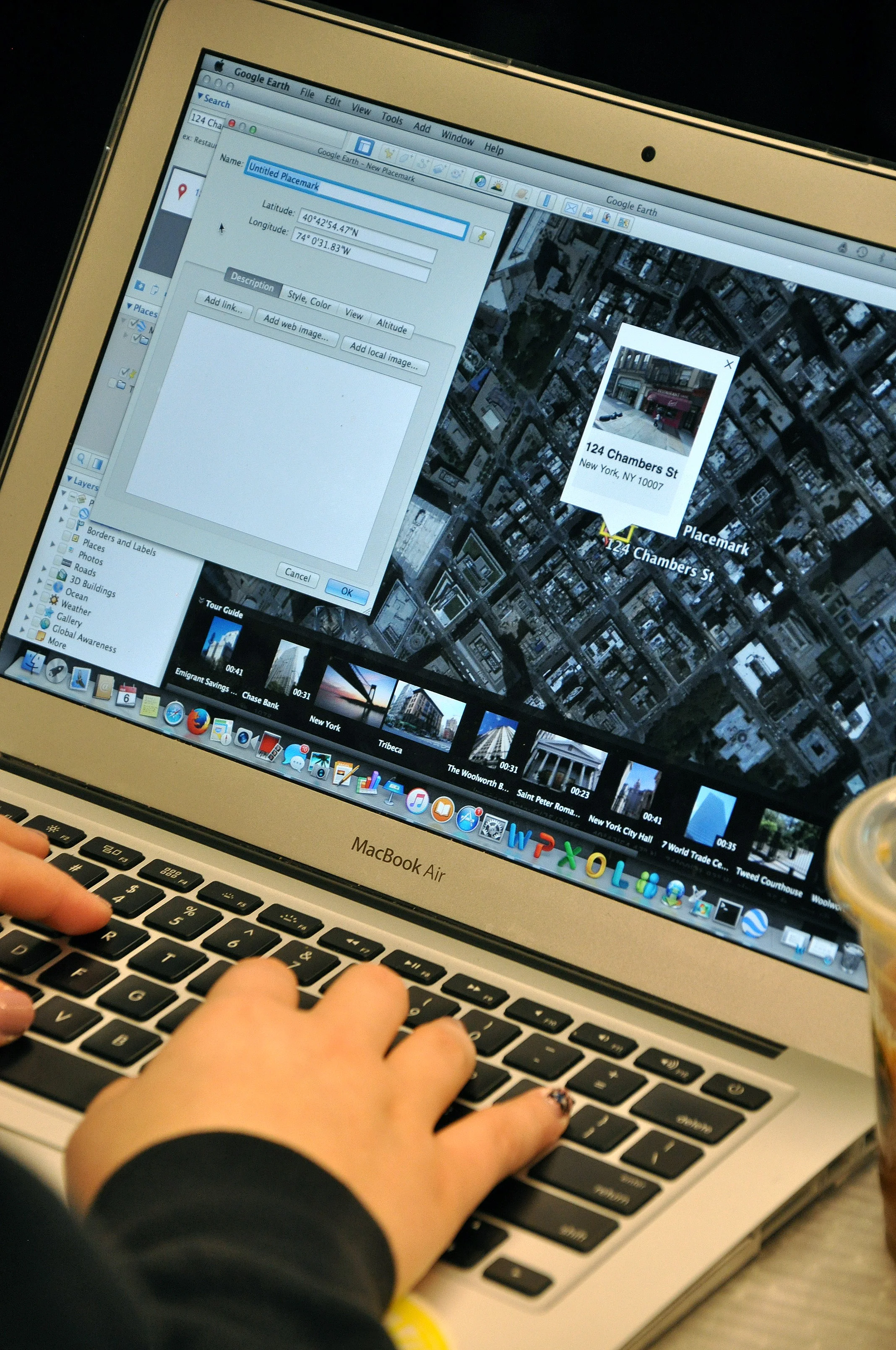
- Office of Elías de Losada, owner of La Revista Ilustrada de Nueva York [Illustrated Magazine of New York] starting around 1890 – 124 Chambers St.
- B. Michael, printer for La Revista Ilustrada de Nueva York [Illustrated Magazine of New York], (1887-1890?) – 62 Anne St.
Group 8
- Nestor Ponce de Léon’s offices and Spanish-language bookstore - 23 Union Square
- Headquarters of La Sociedad Literaria Hispanoamericana de Nueva York [Hispanoamerican Literary Society of New York] – 62 Madison Ave.